Most - but not all - of Watling Street came under the control of turnpike trusts in the 18th century. They improved the roads, sometimes considerably, and recouped the cost via tolls on road users, levied at toll gates, or turnpikes.
I wasn't really expecting to find any actual tollgates on the first phase of this walk, or anything much to remember them by. Just here and there I manged to find the odd thing that remind us there were once tollgates at certain spots.
First up, at Kilburn Bridge, a big housing redevelopment and the hoarding proclaims the hashtag #MyTollgateGardens: an effort to be modern and cool with an old name. A quick check online after coming home and I find that this hashtag has never actually been used by anybody - until I post this, that is. There was indeed a tollgate here; Kilburn Bridge to Sparrow's Hern (on the way to Watford, off Watling Street) was first turnpiked in 1711, and a turnpike from St Giles, via Tyburn, soon followed. The name, which also attached to this area before the present redevelopment, is a memento of the tollgate here, between the two turnpike roads.
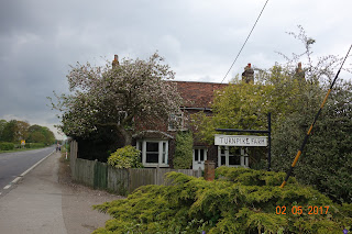
I didn't find anything else for a couple of days. On the way into Dunstable there's a Turnpike Farm, and a check of the First Edition Ordnance Survey map (dated 1834) confirms a tollgate here. A little further on into Dunstable, close to the former Half Moon inn, is a modern building 'Turnpike Court', which I was told marked the site of a tollgate. I thought this was a little too close to Turnpike Farm to be another gate, but these were not fixed forever: delving through
www.turnpikes.org.uk I found that the gate at Turnpike Farm was moved, first to Kensworth Lynch (by the Packhorse, I assume), then to near the Half Moon.
On May 5th, I stopped for lunch at the Crossroads Inn in Weedon Bec, which includes part of a tollhouse. It's not all that obvious, and the staff I spoke to knew nothing of the place's history.
Soon after that, the next possible tollgate location was 'The Old Gatehouse', encountered on a short stretch of the old Watling Street in Long Buckby, Northamptonshire, where the modern road is carried on a 20th century embankment to one side of it. This was the 'Gate Inn' on an 1885 map, and the building I passed looks more like a 19th century inn than an 18th century tollgate. I've found no other indication of a tollgate on the road here, although there was a toll house very close by, not one that would have required a gate, but on the canal. So far, I'm not convinced of this one.
The name of the Royal Redgate pub at Fenny Drayton suggests a possible tollgate, especially as it stands at a junction, where traffic may have been heavier. The pub wasn't yet open when I walked past and I haven't been able to find any firm evidence of a tollgate although the
turnpikes website locates one here.
The name Two Gates, where the present-day A51 crosses the A5, is again suggestive of tollgates, and both were indeed turnpike roads, which would fit, but I found no indication on the ground nor elsewhere.
There's nothing in the name at Four Crosses (Staffordshire, south west of Cannock) and no map indication, but Harper (1902) thought the not-so-old building adjoining it included a toll house, and the
turnpikes website agrees. The building itself doesn't look much like a tollhouse, but I was inclined to feel that the protruding window ledge (pictured) was evidence enough that cash was collected here.
At last, a proper toll house! Burcotgate in Shropshire looks just like it ought to, a Thomas Telford tollhouse and dated 1835. I'm going to find a few more like this along my walk through North Wales.


